Flight Viz
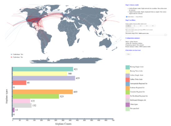
This project is to visualize flights and allow users to explore flight data set. It focuses on three aspects related to the flight data set, namely, the routes distribution among airports, airplane platforms distribution and airline coverage market distribution. The audiences are airline industry and potential airline passengers. More specifically, airline and airport routes are visualized on a geospatial map accompanied with route summaries and detailed statistics to enable the audience to actively interact with for potential decision-making.
Filters in the features enable this audience interaction and the visualization with the configuration summary facilitates the feedback process for exploring further details. Details including airplane statistics by route, origin and maximum trip distance.
Feature Summary:
- Filter instructions
- Airline vs. airport route toggles
- Largest airline codes shortcut
- Airline search box
- Airport search box
- Trip distance filter
- Configuration summary
- Reset button
- Airplane type graphical summary + information hover tooltip
- Route visualization + information hover tooltip


