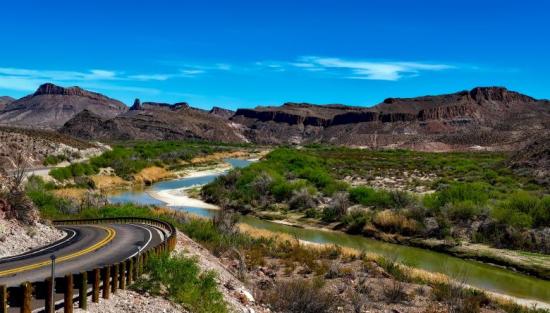
Forecasting Rio Grande Streamflow
Problem & Motivation
The Rio Grande River Basin is facing a severe water management crisis due to several interconnected factors:
- Increasing Water Consumption: Rising demands from urban centers, agricultural operations, and industrial activities are depleting available water resources.
- Water Allocation Issues/Unsustainable Water Rights: Existing water rights allocations exceed the river’s sustainable supply, exacerbating shortages. It is difficult to make long term water allocation decisions based on incomplete data and forecasts are not very confident due to climate change nonlinearities.
- Climate Change: Variability in precipitation, declining snowmelt, and prolonged droughts are reducing streamflow, impacting ecosystems and human livelihoods. Climate change also affects long term trends in the river and makes it difficult for confident decision making.
The Rio Grande provides water resources for millions of people, through supplying drinking water, water sources for agriculture, wildlife habitats, river ecosystem services, and all the leisure activities associated with large rivers. River streamflow is defined as the volume of water moving through a river channel at any given time, and is measured in cubic feet per second, CFS. Streamflow is crucial for water allocation decisions as it is a key metric in understanding water volumes and future river water volumes. Adequate streamflow values ensure consistent water supply and allow for long term health of rivers while also being utilized for community longevity.
Accurate streamflow predictions are essential for managing these resources, but water managers face significant obstacles including incomplete data, prediction limitations, and cascading effects. Limited data from streamflow gages, snow levels, runoff patterns and vegetation impacts make it difficult to have a robust data set with primary and secondary river flow patterns and effects. In addition to that, current forecasting models struggle with accuracy, especially with long term prediction time periods. And the mismanagement of river flow may lead to violating interstate and international water agreements which could create increasing uncertainty and harm communities and ecosystems. In response to these challenges, NASA’s Western Water Applications Office has identified Rio Grande Streamflow Prediction as the “Most Important Priority” in their 2022 Needs Assessment Report. Addressing this priority can enhance water security, ensure equitable distribution, and mitigate climate change impacts. Given all of this, we chose to create an interactive dashboard that could be used by community members and decision makers for enhanced agency and information in decision making. We focused on 3 sites throughout the United States portion of the Rio Grande with 1, 4, 7, and 30 day forecast periods for each site.
Data Source & Data Science Approach
Our modeling approach relies on comprehensive historical data, including:
- US Geological Survey (USGS) Current Water Data for the Nation
- Colorado Division of Water Resources (DWR)
- U.S. Section of the International Boundary and Water Commission United States and Mexico (USIBWC)
- National Water Prediction Service, National Oceanic and Atmospheric Administration (NOAA)
Daily streamflow measurements from our gauge sites span between 4 and 38 years. The key locations that we used were the Rio Grande Near 30 mile bridge outside of Creede in Colorado(RIOMILCO), El Paso Station in Texas, and Big Bend in Texas. The data has strong seasonal patterns that are influenced by precipitation, snowmelt, and dry periods.
Modeling Pipeline
We developed a robust pipeline to process and model the streamflow data:
- Data Collection: Aggregating historical data from multiple sources.
- Data Preprocessing: Handling missing values, normalizing data, and identifying seasonality patterns.
- Model Training: Experimenting with 23 unique models across five categories:
- LSTM (Long Short-Term Memory): Captures long-term dependencies.
- Transformers: Effective for complex sequences.
- Multilayer Perceptron (MLP): Captures non-linear trends but struggles with temporal data.
- Prophet: Interpretable results but limited for non-linear relationships.
- N-BEATS: Excels at univariate time series forecasting.
Model Evaluation
Key metrics for evaluation were Root Mean Square Error (RMSE). The top-performing models for all the 1, 4, 7, and 30 day prediction periods were the N-BEATS models. With the 1, 4, and 7 day forecasts utilizing a 30 day backcast and the 30 day forecast utilizing a 60 day backcast. Our models were validated against federally accepted thresholds (5-10% error). The N-BEATS model achieved an average error of 6.2% for 1-day forecasts, demonstrating high reliability for real-world applications.
Model Insights
N-BEATS Strengths: Captures seasonal variations and extreme streamflow values accurately. Performs well for 30-day forecasts, which are typically challenging for river predictions. It is also robust to changes in streamflow patterns caused by climate change and human activity. Some of the tradeoffs are that it is not as robust in capturing low flow values. Better prediction of high flow values is crucial for stakeholders managing water allocation and flood risks.
Key Learnings & Impact
The modeling efforts achieved reliable predictions for up to 30 days, supporting proactive water management. Models effectively capture seasonal variations and high flow events, crucial for drought mitigation and flood control. The models are also adaptable to climate change impacts and evolving river patterns and can potentially reflect the nonlinearities of climate change.
This has important implications for our users and stakeholders including, improved water management, community resilience, and environmental protection. This also has the potential to expand to other rivers including other endangered rivers and enhance proactive water resource planning.
Acknowledgements
We would like to thank Dr. Erin Urquhart and NASA’s Western Water Applications Office for their invaluable guidance. Thank you to Joyce Shen, Morgan G. Ames, and our peers for their feedback and support.


