SolarScape.AI
Who We Are
SolarScape is a cutting-edge solar assessment tool designed to revolutionize the way individuals, businesses, and policymakers evaluate and adopt solar energy solutions. By combining geospatial data, predictive modeling, and advanced analytics, we aim to empower communities to harness solar energy efficiently and cost-effectively.
Our Mission
Empowering communities to harness the potential of solar energy and sustainable development through innovative data-driven insights, predictive modeling, and advanced computer vision technology. We are committed to helping users make informed decisions and achieve the best return on investment while contributing to a sustainable future.
Our Problems
Solar Potential Uncertainty: Difficulty in accurately assessing solar potential due to factors like roof obstructions and complex property layouts.
Limited Scalability: Existing tools like Google's Project Sunroof often lack the scalability and accuracy needed for commercial and industrial applications.
What We Offer
Our tool offers a comprehensive suite of features that make solar energy evaluation seamless and precise:
- Viability Assessment: Determine if solar energy is right for your property.
- Rooftop Obstruction Detection: Identify potential shading or structural issues.
- Accurate Predictions: Understand your solar energy potential based on precise data.
- Financial Analysis: Explore cost savings, ROI, and break-even timelines tailored to your needs.
Focus on New Mexico
While SolarScape caters to a wide audience, our initial focus is on New Mexico, a state ripe for solar adoption with abundant sunlight and supportive renewable energy policies.
Why Choose Us?
- Innovation: Leveraging advanced geospatial analysis and predictive modeling.
- Precision: Data-rich insights tailored to your property’s unique characteristics.
- Sustainability: Driving renewable energy adoption for a greener planet.
Key Capabilities
- Data-Driven Insights
- Geocoding API: Converts addresses into geographic coordinates for accurate mapping.
- Solar API: Provides solar potential metrics tailored to specific roof properties.
- Maps API: Analyzes rural, residential, and commercial properties using high-resolution imagery (392 images at 1024x1024, zoom level 17).
- Robust Datasets
- DSIRE Dataset: Over 20 years of renewable energy incentives and policies mapped to provide state, sector, and program-specific insights.
- USA Structures Dataset: FEMA data offering footprints of structures (>450 sq. ft.), including square footage, height, and building classification.
- Computer Vision Model
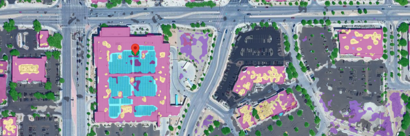
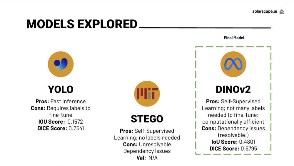
- An advanced model specifically trained to analyze satellite imagery and segment objects within a property's aerial view at the pixel level.
- Custom Scoring Algorithm
- Evaluates properties based on energy potential, obstructions, government incentives, roof life, and roof type.
- Generates a total score and solar installation recommendation, ensuring data-backed decisions.
Key Learnings and Impact:
SolarScape transforms solar viability analysis by using real-time satellite imagery to assess roof obstructions, trees, and open spaces—unlike competitors who rely on pre-indexed data. By adding boundary boxes, we personalize the solar viability score for each property, incorporating state and federal policies, incentives, and obstructions for more precise, actionable insights. Integrating AWS posed a challenge due to the learning curve and navigating dependency issues, but we overcame it to enhance our platform’s capabilities.
Modeling
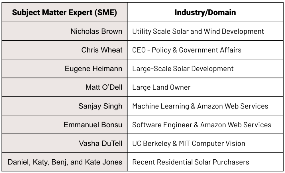
Thank you to Joyce, Korin, and all of our SMEs!!!


